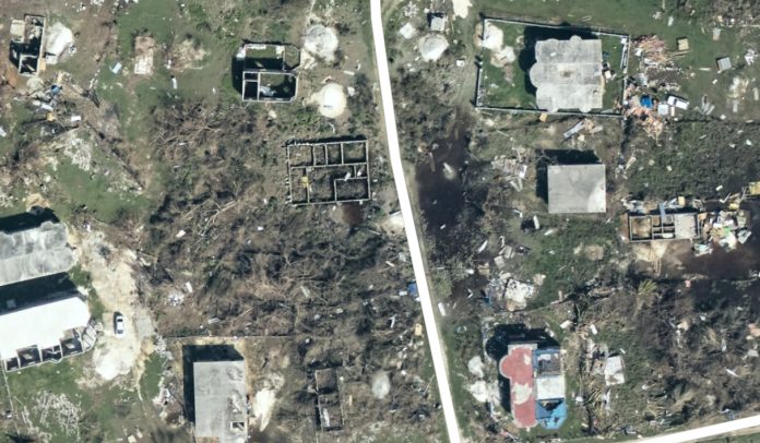
Black River, Jamaica – New aerial imagery from the National Oceanic and Atmospheric Administration (NOAA) reveals widespread destruction across Jamaica’s southern coast following Hurricane Melissa. The photos, released Saturday, show severe structural damage and flooding in St. Elizabeth Parish, including Black River, Luana, and Cambridge.
According to The NOAA Hurricane Hunters, the King Air 360 CER aircraft #NOAA65 continues to collect imagery for the National Ocean Service. These high-resolution assessments are used to determine the full extent of the damage and to guide recovery and rebuilding operations.
In the aerials, several neighborhoods near Black River appear inundated, with debris scattered and roofs torn away. Areas near Luana and the coastal plain show what appear to be flooded fields, downed trees, and collapsed buildings — evidence of Melissa’s powerful winds and storm surge.
Local authorities and emergency teams are using the NOAA data to coordinate relief distribution and infrastructure inspections. Power and road restoration efforts remain underway across several southern communities.
Residents are urged to monitor official updates as the National Works Agency and Jamaica Public Service continue post-storm repairs.
The latest damage imagery can be viewed publicly through NOAA’s storm viewer at storms.ngs.noaa.gov/storms/melissa.


