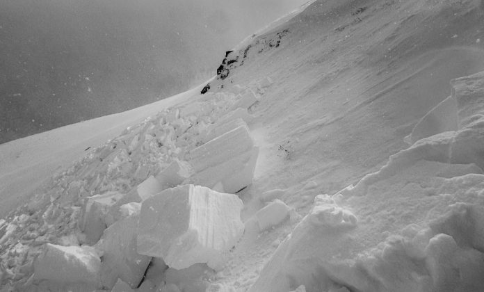
San Juan Mountains, CO – A small human-triggered avalanche was reported Tuesday near Red Mountain Pass in the San Juan Mountains, highlighting changing snow conditions across Colorado’s high country. According to the Colorado Avalanche Information Center (CAIC), the slide occurred on an east-northeast-facing slope near a saddle above 12,000 feet, where fresh wind-loaded snow sat atop older, firmer layers.
CAIC says avalanche danger today remains LOW for most of Colorado, but recent wind events have created unstable surface slabs on steep, high alpine, north-facing slopes. These “wind slab avalanches” can be triggered easily and are most likely above treeline in areas such as the northern San Juan Mountains, the West Elk Mountains, and the Park Range.
According to CAIC forecasters, conditions are expected to change significantly starting Thursday, when new storms push into the state. As snow begins to accumulate, avalanche danger is expected to increase and become more complex through the weekend.
Backcountry travelers are urged to watch for slopes steeper than 30 degrees, especially where smooth, rounded wind drifts sit on top of older, hard-packed snow. Areas with shallow or patchy early-season coverage may have lower risk, but high alpine zones continue to carry instability.
Images shared by CAIC show cracked, broken snow slabs on a steep mountainside, consistent with a wind slab release triggered by a person traveling through the area.
Forecasters recommend checking daily updates before heading into the backcountry.


